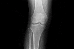
Anatomical surface reconstruction with sparse set of points
Tree Detection and Related Applications in Forestry
Using aerial images taken by drone, plane or satellite, RSIP Vision can create forestry image processing and analysis software to efficiently determine: Trees detection Automatic
Forestry Row Detection and Related Applications
RSIP Vision creates forestry image processing and analysis software by using aerial images taken by drone, plane or satellite. Our algorithms enable to efficiently determine:
Bounded Objects Detection and Related Applications in Forestry
Using aerial images taken by drone, plane or satellite, RSIP Vision develops software for image processing and analysis in forestry to efficiently determine: Forest border

Automatic human action recognition in videos

Automatic semantic tagging of images

Automatic video categorization of new item

Visual Search and Video Recommendation

Vehicle Localization with Lane Tracking

Pedestrian Detection with Machine Learning
Anatomical surface reconstruction with sparse set of points
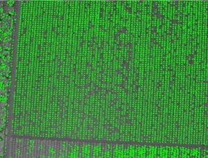
Tree Detection and Related Applications in Forestry
Using aerial images taken by drone, plane or satellite, RSIP Vision can create forestry image processing and analysis software to efficiently determine: Trees detection Automatic
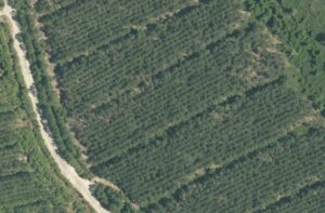
Forestry Row Detection and Related Applications
RSIP Vision creates forestry image processing and analysis software by using aerial images taken by drone, plane or satellite. Our algorithms enable to efficiently determine:
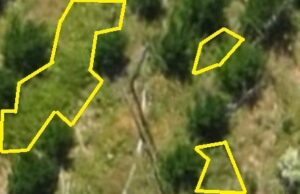
Bounded Objects Detection and Related Applications in Forestry
Using aerial images taken by drone, plane or satellite, RSIP Vision develops software for image processing and analysis in forestry to efficiently determine: Forest border
Automatic human action recognition in videos
Automatic semantic tagging of images
Automatic video categorization of new item
Visual Search and Video Recommendation
Vehicle Localization with Lane Tracking